GIS & Mapping

Geographic Information Systems (GIS)
The Northwest Florida Water Management District’s (NWFWMD) Geographic Information Systems (GIS) staff builds and maintains spatial datasets and applications, conducts GIS projects, and publishes GIS maps for the agency’s divisions in support of the Districts mission to protect water and natural resources of the state of Florida. This database includes a considerable amount of information that is potentially of value to federal, state, regional, and local governmental agencies, as well as private businesses and the public. NWFWMD GIS staff currently utilizes ArcGIS, a full suite of products by Environmental Systems Research Institute, Inc (ESRI) software.
GIS/Spatial Data Links
 |
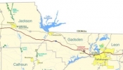
Map LibraryThe Map Library contains district maps pertaining to political boundaries, watersheds, planning regions, ownership, acquisition, and service locations. |
 |
GIS Data DirectoryThe GIS Data Directory contains geographic data and information that can be of value to federal, state, regional and local governmental agencys, as well as private business and the public. |
 |
NWFWMD Specific-use Data SitesDistrict sponsored specific-use data sites: Flood Information Portal, Public Lidar Data Server, Map Modernization and Wetland Mitigation |

