
Map Library
The District Maps Library contains a printable collection of various GIS generated maps specific to the Northwest Florida Water Management District. The NWFWMD GIS Division prepares a variety of maps to support informed decision-making by District staff, agencies, businesses, and the public.
The District Maps Library was updated in September 2020 and is located it the Updated Map Library. Some maps on this page have been updated and are located in the Updated Map Library.
Maps are in Adobe PDF file ![]()
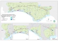 |
Reuse and Wastewater TreatmentThis map shows the locations of Reuse and Wastewater Treatment in the Northwest Florida Water Management District. July 11, 2016 | 38″ X 56″ | 4MB |
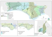 |
Water ResourcesThis map shows the Water Resources in the Northwest Florida Water Management District. October 11, 2016 | 38″ X 56″ | 4MB |
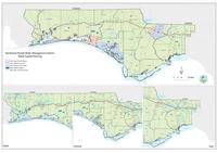 |
Water Supply PlanningThis map shows Water Supply Planning in the Northwest Florida Water Management District. July 11, 2016 | 38″ X 56″ | 4MB |
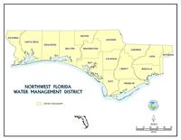 |
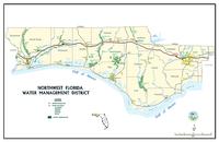
Northwest Florida Water Management DistrictThis map shows the extent of Northwest Florida Water Management District March 11, 2014 | 81/2″ X 11″ | 1.0MB |
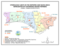 |
Basin Areas Represented by Governing Board MembersThis map depicts the basin areas represented by Northwest Florida Water Management District Governing Board Members March 11, 2014 | 81/2″ X 11″ | 1.1MB PDF |
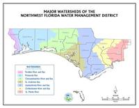 |
WatershedsThis map depicts the watersheds within Northwest Florida Water Management District March 11, 2014 | 81/2″ X 11″ | 1.1MB PDF |
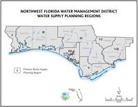 |
Water Supply Planning RegionsThis map depicts the water supply planning regions for the Northwest Florida Water Management District March 11, 2014 | 81/2″ X 11″ | 1.2MB PDF |
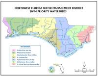 |
SWIM Priority WatershedsThis map depicts the SWIM Priority Watersheds for the Northwest Florida Water Management District March 11, 2014 | 81/2″ X 11″ | 1.1MB PDF |
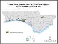 |
Water Resource Caution AreaThis map depicts the water resource caution areas within Northwest Florida Water Management District March 11, 2014 | 81/2″ X 11″ | 1.0MB PDF |
 |
District OwnershipThis map depicts lands owned and managed by Northwest Florida Water Management District March 11, 2014 | 81/2″ X 11″ | 1.2MB PDF |
 |
District Conservation EasementsThis map depicts lands with a conservation easement retained by Northwest Florida Water Management District. March 11, 2014 | 81/2″ X 11″ | 1.0MB PDF |
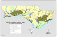 |
Five Year Acquisition PlanThis map depicts the area in which Northwest Florida Water Management District has established as area of potential acquisition. March 11, 2014 | 81/2″ X 11″ | 1.9MB PDF |
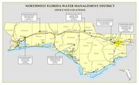 |
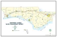
District Office LocationsThis map depicts the office locations of Northwest Florida Water Management District March 11, 2014 | 81/2″ X 11″ | 1.4MB PDF |