
Surface Water Improvement and Management
Northwest Florida Watersheds Partnership Program
The Northwest Florida Watersheds Partnership Program will provide funding for planning, data collection, design, and implementation of projects to enhance water quality, aquatic habitat, and water supply in priority sub-basins within the Northwest Florida Water Management District.
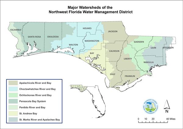
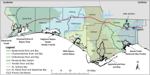
This new program builds upon prior work to develop Surface Water Improvement and Management (SWIM) plans for each of the District’s seven major watersheds. Under the Watersheds Partnership Program, one priority sub-basin will be selected within each of the seven major watersheds where focused planning, coordination, and funding will facilitate the implementation of projects to address critical water resource issues. Work plans developed for each priority sub-basin will include a description of the basin, water resource issues and causes, projects that can address and remedy critical issues, and associated funding needs.
The Program will be implemented in coordination with local and county governments, regional entities, and other interested and affected parties to maximize effectiveness. These potential partners include the Florida Department of Environmental Protection, the Apalachicola National Estuarine Research Reserve, the Choctawhatchee Basin Alliance, and the three Panhandle Estuary Programs: the Pensacola and Perdido Bays Estuary Program, Choctawhatchee Bay Estuary Program, and the St. Andrew and St. Joseph Bays Estuary Program.
During October 2025, the District hosted public workshops for each of the seven watersheds to share information about the program and obtain input regarding the prioritization of sub-basins for work plan development. In addition to the public meetings, the District accepted input via online surveys.
Map showing the selected Sub-basins for the Watersheds Partnership Program
St. Andrews Bay Watershed
Mill Bayou-Watson Bayou Overview
Mill Bayou-Watson Bayou Sub-basin Work Plan
Workshop PowerPoint: St. Andrews Presentation
Ochlockonee River and Bay Watershed
Lake Jackson Overview
Lake Jackson Sub-basin Work Plan
Workshop PowerPoint: Ochlockonee River and Bay Presentation
St. Marks River and Apalachee Bay Watershed
Goose Creek-Dickerson Bay Overview
Goose Creek-Dickerson Bay Sub-basin Work Plan
Workshop PowerPoint: St. Marks River and Apalachee Bay Presentation
Choctawhatchee River and Bay Watershed
Destin Harbor-Hogtown Bayou Overview
Destin Harbor-Hogtown Bayou Sub-basin Work Plan
Workshop PowerPoint: Choctawhatchee River and Bay Presentation
Perdido and Pensacola Bays Watersheds
Bayou Texar Overview
Bayou Texar Sub-basin Work Plan
Elevenmile Creek Overview
Elevenmile Creek Sub-basin Work Plan
Workshop PowerPoint: Pensacola and Perdido Bay Presentation
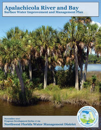
Apalachicola River and Bay Watershed
Apalachicola River and Bay Overview
Apalachicola River and Bay Sub-basin Work Plan
Workshop PowerPoint: Apalachicola River and Bay Presentation
For additional information, please contact Darryl Boudreau at Darryl.Boudreau@nwfwater.com or by phone at (850) 207-4477, or Jerrick Saquibal at Jerrick.Saquibal@nwfwater.com, or by phone at (850) 539-5999
SWIM Plans
SWIM plans are developed to address, on a watershed basis, cumulative anthropogenic impacts to water quality and aquatic habitats. They incorporate comprehensive strategies to both restore and to protect watershed resources. Implementation is accomplished through a variety of activities, such as retrofitting stormwater management systems to improve water quality and flood protection; restoring wetland and aquatic habitats; supporting enhanced wastewater management and treatment; evaluating resource conditions and freshwater needs; protecting and restoring springs; and providing public outreach and awareness.
The SWIM program also supports coordination of state and federal grants and implementation of cooperative projects with local governments.
Historically, SWIM plan implementation has integrated and leveraged a variety of funding sources, including SWIM (sections 373.451-373.459, F.S.), the Water Management Lands Trust Fund (section 373.59, F.S.), the Ecosystem Management and Restoration Trust Fund (section 403.1651, F.S.), Florida Forever (section 259.105 and section 373.199, F.S.), legislative special appropriations, the Water Protection and Sustainability Program (section 403.890, F.S.), state and federal grants, and funding through local government partnerships. Cumulatively, the overall effort has resulted in significant protection and improvement of water resources District-wide.
SWIM priority waterbodies of the Northwest Florida Water Management District are listed below. The waterbodies listed are inclusive of all tributaries, sub-embayments, and contributing watershed areas.
Watershed
 |
Apalachicola River and Bay Watershed Apalachicola River, Apalachicola Bay and adjacent estuarine waters, Chipola River, New River, Lake Seminole, Alligator Harbor |
Updated SWIM Plan Approved November 2017 |
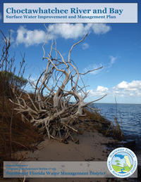 |
Choctawhatchee River and Bay Watershed Choctawhatchee River, Holmes Creek, Choctawhatchee Bay, Coastal dune lakes |
Updated SWIM Plan Approved October 2017 (Revised February 26, 2018) |
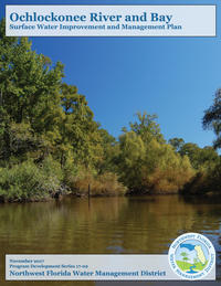 |
Ochlockonee River and Bay Watershed Ochlockonee Bay, Ochlockonee River, Sopchoppy River, Lake Jackson, Lake Iamonia |
Updated SWIM Plan
Approved September 2017 |
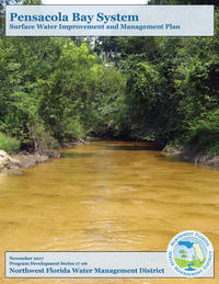 |
Escambia River, Blackwater River, Yellow River, Shoal River and East Bay rivers and their tributaries, Pensacola Bay, Escambia Bay, |
Updated SWIM Plan
Approved October 2017 |
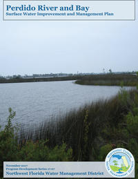 |
Perdido River and Bay Watershed Perdido River, Perdido Bay, Big Lagoon |
Updated SWIM Plan
Approved October 2017 |
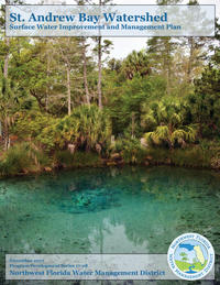 |
St. Andrew Bay, North Bay, West Bay, East Bay, St. Joseph Bay, Deer Point Lake Reservoir, Econfina Creek and springs, |
Updated SWIM Plan
Approved November 2017 |
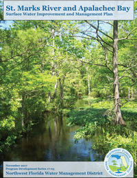 |
St. Marks River and Apalachee Bay Watershed St. Marks River, Wakulla River, Wakulla Spring, Lake Miccosukee, Lake Lafayette, Lake Munson, Apalachee Bay |
Updated SWIM Plan
Approved September 2017 |