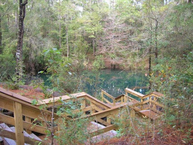
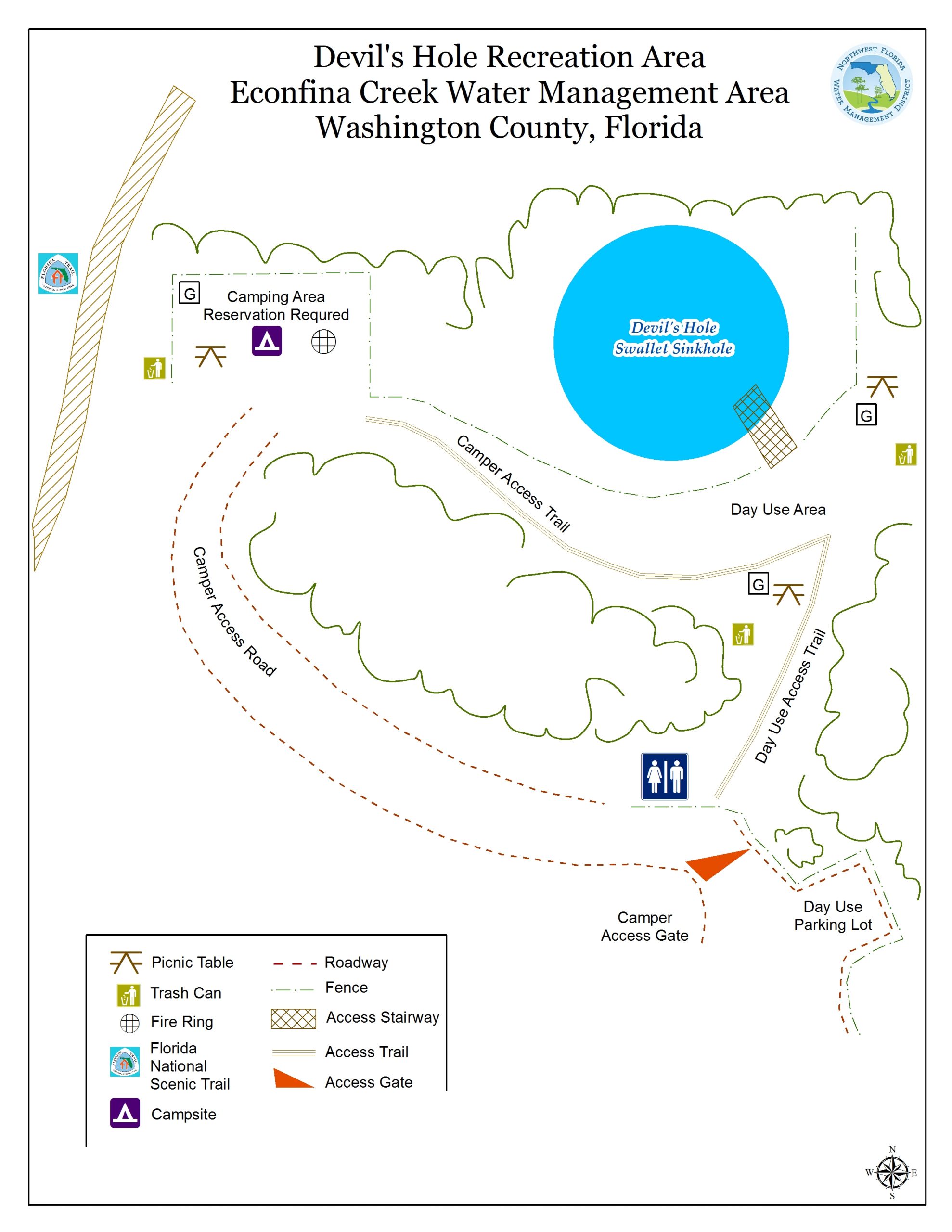
Located approximately 14 miles northwest of Youngstown, Devil’s Hole Recreation Area showcases a 40-foot swallet sinkhole that connects to the Floridan Aquifer.
The most direct route to Devil’s Hole is via Porter Pond Road, which is slightly west of the bridge at State Road 20 where it crosses Econfina Creek. Once on Porter Pond Road, travelers will see signage with arrows and mileage at each key intersection to help locate the recreation area.
Devil’s Hole is located approximately 7 miles north of State Road 20.
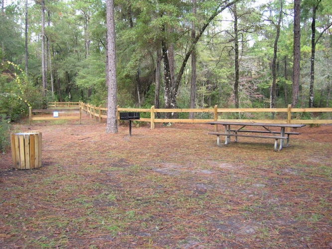
The recreation area offers picnic tables, a portable toilet, and a single campsite equipped with picnic table, fire ring, and a grill. The campsite is available by reservation.
The Florida National Scenic Trail passes through the area just to the west of Devil’s Hole. Look for the orange markers to identify the Scenic Trail.
Visitors to Devil’s Hole can take a short walk down a dirt road to nearby Walsingham Park, which overlooks Econfina Creek. Three other primitive campsites are also within a short walk from Devil’s Hole – Seashell Recreation Area, Longleaf Recreation Area, and Walsingham Camp Recreation Area.
Recreation Opportunities
- Camping, picnicking, wildlife viewing.
Restrictions
No ATV’s allowed.
Motorized vehicles allowed on designated roads only.
Alcoholic beverages prohibited.
Tent, pickup, or van camping only; RV’s or trailers not allowed.
